Is Thessaloniki A Walkable City?
Is Thessaloniki a walkable city? A plain answer from the map and the operator pages: what sits within reach of Aristotelous Square, where walking stops being practical, and how the metro and buses cover the rest.
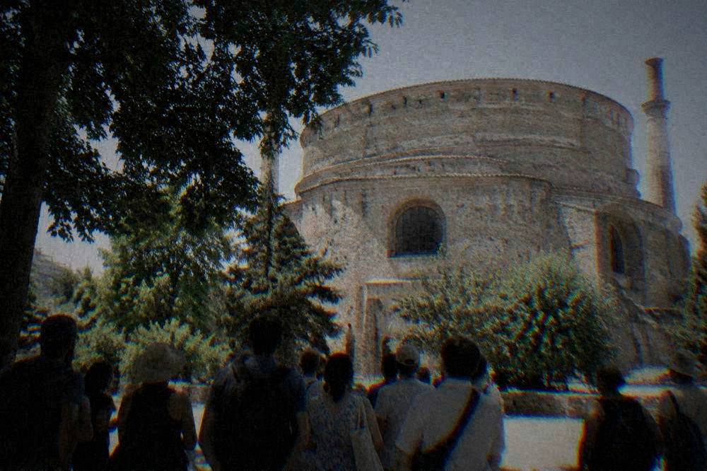
Thessaloniki, the second city of Greece, sits on the Thermaic Gulf in Central Macedonia with its landmark sights strung along one seafront axis: the White Tower on the Nea Paralia promenade, Aristotelous Square at the centre, the Roman Galerian complex on Egnatia street, and the old upper town of Ano Poli climbing inside the Byzantine walls above it all.
Is Thessaloniki A Walkable City?
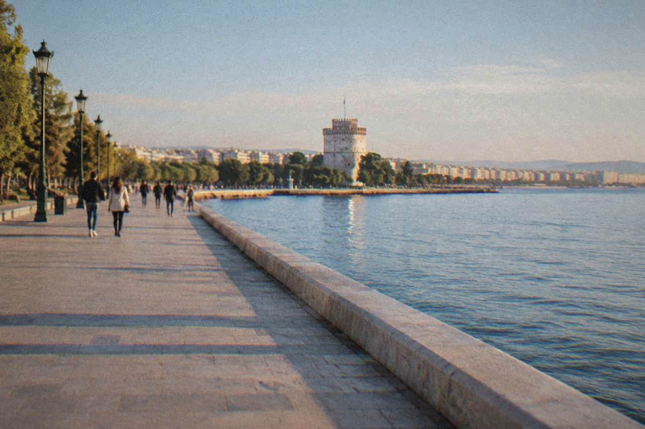
Yes, in its central belt: the White Tower, Aristotelous Square, the Arch of Galerius, the Rotunda, Hagia Sophia and the Ladadika district all sit within an easy stroll of one another along the flat seafront and Egnatia axis, and the Nea Paralia is a continuous promenade built for walking. Ano Poli, the old upper town, is also walkable but steeply uphill inside the walls, so the honest answer is a compact, walkable core with one genuine hill.
That compactness is not a marketing claim, it is a fact of the city's shape. Fifteen Paleochristian and Byzantine monuments, inscribed on the UNESCO World Heritage List in 1988, are packed into the central districts rather than scattered across a sprawl, which is why a walking tour of the city works at all. The municipality's own visitor materials describe the sights as a series of connected walks radiating from the centre, and the geography backs that up: the seafront runs flat from the port to the White Tower and on into the Nea Paralia, while Egnatia street carries the Roman and Byzantine monuments in a rough line inland.
What the flat centre does not include is the upper town. Ano Poli sits above the centre inside the walls, and the climb from the Church of Saint Demetrius up to the Heptapyrgion fortress is a sustained slope on old cobbled lanes. Walkable, yes. Effortless, no. Anyone with mobility limits should treat Ano Poli as a separate, harder outing and enjoy the flat seafront belt on its own.
| Sight pair | What connects them | Character of the ground |
|---|---|---|
| White Tower to Aristotelous Square | Seafront promenade | Flat, continuous, paved |
| Aristotelous Square to Arch of Galerius | Egnatia street axis | Flat, urban, signalised crossings |
| Arch of Galerius to Rotunda | Adjacent blocks of the Galerian complex | Flat, minutes apart |
| Church of Saint Demetrius to Heptapyrgion | Ano Poli lanes inside the walls | Steep, cobbled, sustained climb |
| Ladadika to the port district | Contiguous historic quarter | Flat, cobbled streets |
Which Parts Of Thessaloniki Are Best Explored On Foot?
The flat central belt is the walking heart of the city: the seafront from the port past the White Tower into the Nea Paralia promenade, Egnatia street with the Arch of Galerius and the Rotunda, Aristotelous Square, the Ladadika quarter and the market streets around Modiano Market and Kapani Market. Ano Poli rewards walkers who accept the hill with walls, lanes and views over the Thermaic Gulf.
The promenade deserves its own sentence because it is the one piece of the city built explicitly for pedestrians. The Nea Paralia is a promenade, not a beach, and older pages that describe swimming off the city waterfront are simply wrong; swimming happens at Perea, about 28 minutes away by road, at Agia Triada or at Epanomi. For walking, though, the promenade is the spine of the city: it links the White Tower to the eastern suburbs on foot and doubles as the city's running and cycling track.
Inland, the markets give the walk a rhythm. Modiano Market and Kapani Market sit a short walk north of Aristotelous Square, and the Ladadika quarter west of the centre concentrates the old commercial streets. A reasonable walking day covers the promenade in the morning, the markets and Egnatia monuments at midday, and Ano Poli in the late afternoon, when the light across the gulf is the reason people climb up there at all. The city's one day itinerary is built on exactly that logic.
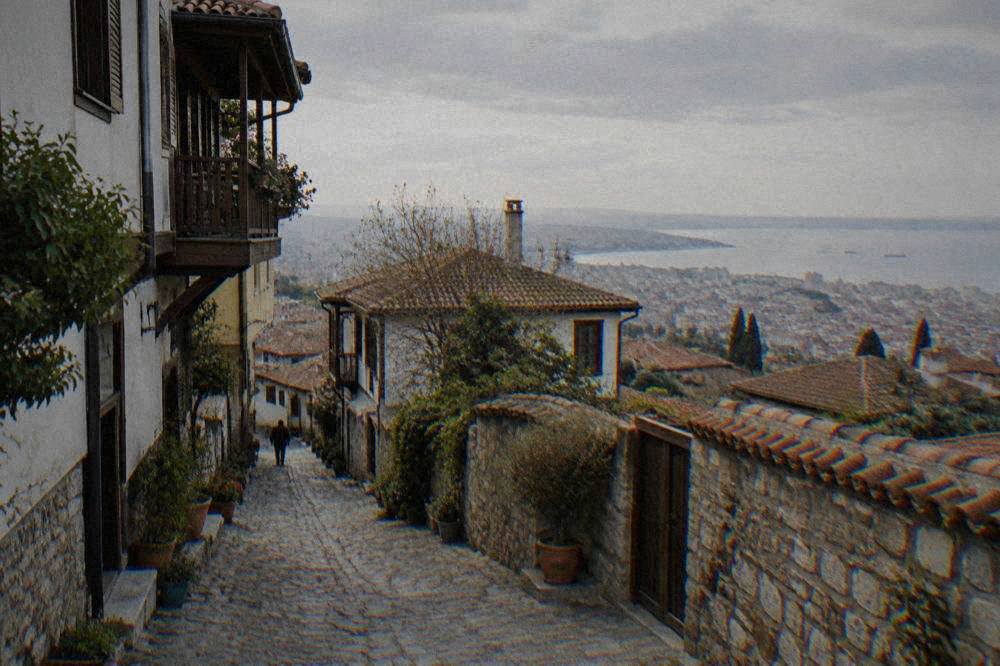
Guided walks are one way to give the upper town a structure, and the site's Thessaloniki Travel Guide page collects the walking options. The trio below covers the city on foot from three angles: the upper town and its history, the street food of the market streets, and, for the day the legs need a rest, a thermal baths and waterfalls trip out of town.
Where Does Walking In Thessaloniki Stop Being Practical?
Walking stops being practical in three cases: the climb into Ano Poli for anyone with mobility limits, the longer cross town hops into Kalamaria and the eastern suburbs, and every day trip, from Perea at about 28 minutes by road to Meteora at about 228 km, which is a full day by any mode. The metro, the OASTH buses and taxis cover all three, and Line 1 has been open since November 2024.
Start with the day trips, because they are where walkability ends entirely. No amount of pedestrian virtue changes that arithmetic; the question of how many days is enough for Thessaloniki usually comes down to how many of these trips a visitor bolts onto the city itself.
| Day trip destination | Road distance from Aristotelous Square | Free flow drive time |
|---|---|---|
| Perea (nearest swimming beaches) | 23.0 km | about 28 min |
| Pella (Archaeological Museum) | 45.7 km | about 43 min |
| Vergina (Royal Tombs of Aigai) | 68.0 km | about 62 min |
| Dion (archaeological park) | 90.1 km | about 67 min |
| Edessa (waterfalls) | 90.3 km | about 82 min |
| Kassandra (Kallithea) | 86.2 km | about 78 min |
| Sithonia (Nikiti) | 97.2 km | about 96 min |
| Meteora (Kalambaka) | 227.5 km | about 154 min |
Inside the city, the hills of Ano Poli are the first limit. The second is simple distance: Kalamaria, the eastern suburb reached by the promenade, is a long walk out and an easy ride back. This is where the metro matters, and where a stubborn myth needs one sentence of correction: older guides still say Thessaloniki has no metro or that it is under construction, which is out of date. Line 1 opened in November 2024 and the Kalamaria extension was inaugurated on 27 August 2026.
How Does The Metro Change Walking In Thessaloniki?
The Thessaloniki Metro's own ticket page lists a basic ticket at 0.60 euro and a daily ticket at 2.50 euro, and the operator's page gives running hours of 05:15 to 00:30 Sunday to Thursday and 05:15 to 02:00 Friday and Saturday. Line 1 runs from the New Railway Station to Nea Elvetia, with the Kalamaria extension reaching Mikra since 27 August 2026.
For a walking visitor the practical effect is that the city's two ends are stitched together. A walk that starts at the Rotunda can end in Kalamaria, or the reverse, with the metro as the return leg, and the airport has its own bus connections: OASTH lists the X1, X2 and X3 airport lines plus the night N1, with X2 serving Nea Elvetia metro station and X3 serving Mikra.
One planning note that pairs well with walking: the state museums have fixed hours worth checking on the day. The Archaeological Museum lists 09:00 to 17:00, closed Tuesdays from 1 November to 31 March, and the White Tower lists 08:00 to 21:00 in summer and 08:30 to 15:30 in winter, with entry stopping 20 minutes before closing. A walking route that arrives at 20:50 does not get in.
What Is The Best Season For Walking In Thessaloniki?
The HNMS Thessaloniki Mikra station table, 1959 to 2010, shows July averaging a mean daily high of 31.7 C and August 31.4 C, while April averages 19.1 C and October 21.2 C, with December the rainier end of the year at 55.1 mm against August's 19.3 mm. Spring and autumn are the seasons the numbers favour for long days on foot, and winter walking is a matter of rain days rather than cold extremes.
| Month | Mean high C | Mean low C | Rain mm |
|---|---|---|---|
| April | 19.1 | 7.9 | 36.1 |
| May | 24.6 | 12.6 | 44.2 |
| June | 29.4 | 17.0 | 29.8 |
| July | 31.7 | 19.3 | 23.8 |
| September | 27.1 | 15.4 | 29.8 |
| October | 21.2 | 11.3 | 43.0 |
The table is a weather station record, not a forecast, but it shapes a sensible walking plan: promenade mornings in summer before the mean high arrives, Ano Poli in the cooler hours, and museum hours used as the midday shelter. October deserves its own mention because the city layers events onto the weather, from the Dimitria festival, reported at 1 to 26 October in 2026, to Saint Demetrius day on 26 October and Ochi Day on 28 October. The page on Thessaloniki in October takes that season in full.
How Does A Guided Walk Fit A Walking City?
In a city whose sights concentrate along one axis, a guided walking tour compresses the orientation problem into a single outing: a local guide covers the upper town's walls and viewpoints, or the market streets' food culture, in one structured walk instead of a visitor assembling them from a map. The tours below are the site's featured picks for exactly that, led by locals and bookable with free cancellation on the operator's live listing.
The upper town walk is the one this site features most often, because Ano Poli is the district where a guide earns their keep: the lanes inside the walls are easy to circle without ever reaching the Heptapyrgion or the best viewpoints, and the Byzantine and Ottoman layers are easier to read with someone naming them. For visitors weighing the city against the capital, it is one of the differences that shows up in Athens or Thessaloniki comparisons: a walkable core where the main monuments sit close together.
The same logic applies to food. The streets around Modiano Market and Kapani Market are walkable in the plain sense, but a street food walk with a local guide turns them from a corridor into an explanation, and the trio below ends with the Pozar thermal baths and Edessa trip for the day the walking legs want a hot soak instead of another hill.
Common Questions About Walking In Thessaloniki
Is Thessaloniki A Walkable City?
Yes, in its central belt: the White Tower, Aristotelous Square, the Galerian complex, Hagia Sophia and Ladadika all sit within a stroll of one another on flat ground, and the Nea Paralia is a purpose built promenade. Ano Poli is walkable but steeply uphill, and every day trip beyond the city needs a vehicle or the metro and buses.
Can you walk from the White Tower to Aristotelous Square?
Yes. They sit on the same flat seafront promenade a short stroll apart, with the walking continuing east into the Nea Paralia and west into the Ladadika quarter and the port district without any significant slope.
Is Ano Poli too steep to walk?
Ano Poli is a sustained uphill walk on cobbled lanes inside the Byzantine walls, ending at the Heptapyrgion fortress at the top.
Do you need the metro if the centre is walkable?
Not for the central sights, but the metro helps for the longer hops: Line 1, open since November 2024 with the Kalamaria extension inaugurated 27 August 2026, runs 05:15 to 00:30 Sunday to Thursday and 05:15 to 02:00 Friday and Saturday, with a 0.60 euro basic ticket and a 2.50 euro daily ticket per the operator's ticket page.
Is the Thessaloniki seafront good for long walks?
The Nea Paralia is a promenade built exactly for that, running flat along the Thermaic Gulf from the White Tower eastward. It is not a swimming beach; swimming is at Perea, about 28 minutes away by road, at Agia Triada or at Epanomi.
Is Thessaloniki walkable at night?
The seafront and central streets are lit and active in the evening, and the city's restaurants and bars concentrate in walkable central quarters. This site holds no safety statistics and publishes no area rankings; general precautions apply as in any city, and the emergency number throughout Greece is 112.