Trigoniou Tower And The Byzantine City Walls
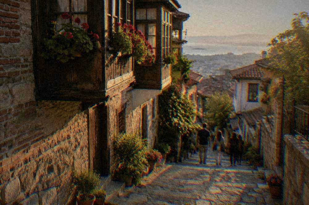
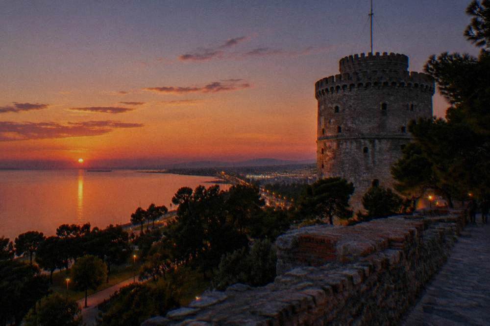
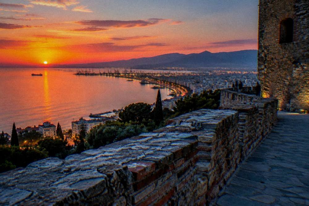
The Trigoniou Tower stands at the highest stretch of Thessaloniki's Byzantine walls, where Ano Poli meets the fortress of the Heptapyrgion, and it frames one of the clearest views over the Thermaic Gulf in the city.
Short answer
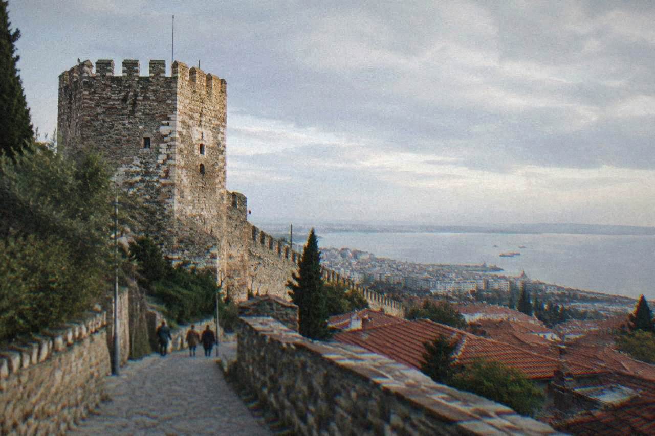
The Trigoniou Tower is a stone tower on the Byzantine city walls of Thessaloniki, at the top of Ano Poli beside the Heptapyrgion fortress. The walls are part of a UNESCO-listed ensemble of fifteen Paleochristian and Byzantine monuments inscribed in 1988, and the tower is reached on foot through the upper town's lanes.
The Trigoniou Tower stands where the Byzantine city walls of Thessaloniki climb to their highest point, at the northern edge of Ano Poli and a short walk from the Heptapyrgion fortress. From its base the whole of Thessaloniki opens below: the rooftops of the old upper town, the Thermaic Gulf, and on clear days the silhouette of Mount Olympus across the water. This page sets out what the tower is, what the walls around it are made of, how to reach them on foot, and how the visit fits into a wider route through the city's UNESCO-listed Byzantine monuments, of which the walls are one of fifteen inscribed in 1988.
The city itself is the second city of Greece, in Central Macedonia, on the coast of the Thermaic Gulf. It was founded in 315 BC by Cassander and named for his wife Thessalonike, a daughter of Philip II, and it grew into a Roman provincial capital, a Byzantine metropolis and an Ottoman port before its liberation on 26 October 1912. The walls you walk beside at the tower belong to that layered story: Hellenistic in origin, expanded in the Byzantine period, and strengthened again under the Ottomans. The original circuit ran about 8 km, and roughly 4 km remains visible today, with the best-preserved and most atmospheric stretch in Ano Poli, the old upper town.
What Is The Trigoniou Tower In Thessaloniki?
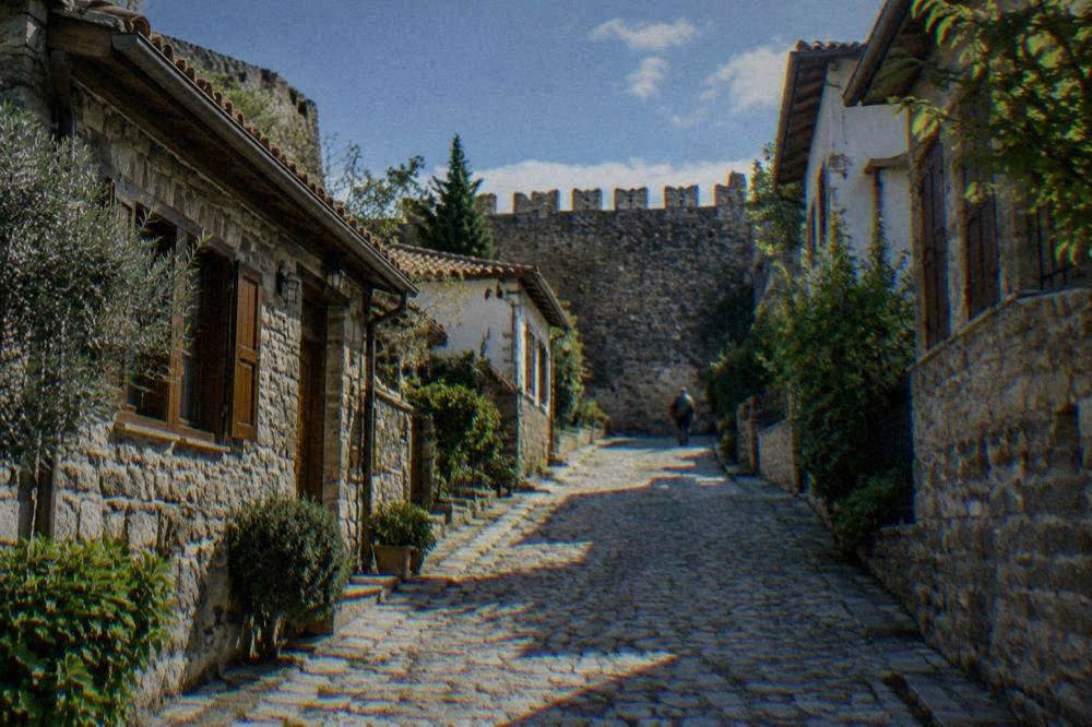
The Trigoniou Tower is a stone defensive tower set on the Byzantine city walls of Thessaloniki, at the point above Ano Poli where the wall line turns near the Heptapyrgion fortress, and it is a viewing landmark rather than a museum: there is no ticket desk, no collection and no interior exhibition, and the reason to come is the panorama over the old town and the Thermaic Gulf. The name refers to its triangular position in the wall circuit, at the junction where the acropolis defences meet the long line running down toward the sea. It is one of the most photographed structures in the upper town, and the terrace ground around it functions as an open-air viewpoint at any hour.
The tower belongs to the ensemble of fortifications that the Ministry of Culture's own monument pages treat as a single subject with the Heptapyrgion and the walls. The Heptapyrgion, the fortress at the top of the walls also called Yedi Kule, was used as a prison from the late 19th century until 1989, and the city's walk documentation notes the prison history alongside the walls' Hellenistic origins and Byzantine expansion. Walking the wall path between the Heptapyrgion and the Trigoniou Tower, then down toward the Vlatadon Monastery, is the standard upper-town circuit, and it passes the whole surviving sequence: fortress, towers, curtain wall and gates.
What the tower is not is a ticketed attraction in the museum sense. The churches of the upper town, such as the Vlatadon Monastery and the Church of Saint Nicholas Orfanos, are working churches, free to enter and open outside services; the tower and the walls are open-air structures visible at any time. No entry price is listed for the Heptapyrgion or the walls, so confirm the current arrangement on the relevant official ticket page before planning a fortress interior visit.
| Structure on the wall circuit | What it is | Access as documented |
|---|---|---|
| Trigoniou Tower | Stone tower at the wall's high point above Ano Poli | Open-air, viewed from the surrounding terrace |
| Heptapyrgion (Yedi Kule) | Fortress at the top of the walls, a prison until 1989 | Confirm hours and ticket on the official page |
| Byzantine curtain wall | Roughly 4 km visible of an original about 8 km | Open-air, walked along public paths |
| Vlatadon Monastery | Working monastery inside the walls, UNESCO-listed ensemble | Free, open outside services |
| Church of Saint Nicholas Orfanos | Byzantine church in Ano Poli | Free, open outside services |
For travellers who want the upper town explained rather than simply found, a guided walk is the practical option. The Best of Thessaloniki: Tour by Local covers the city's headline sights with an upper-town component, and you can Check availability on the operator's live listing. The walk up through Ano Poli is described in detail in the site's Thessaloniki walking tour guide, and the wider monument context sits in Byzantine churches of Thessaloniki.
How Old Are The City Walls Of Thessaloniki?
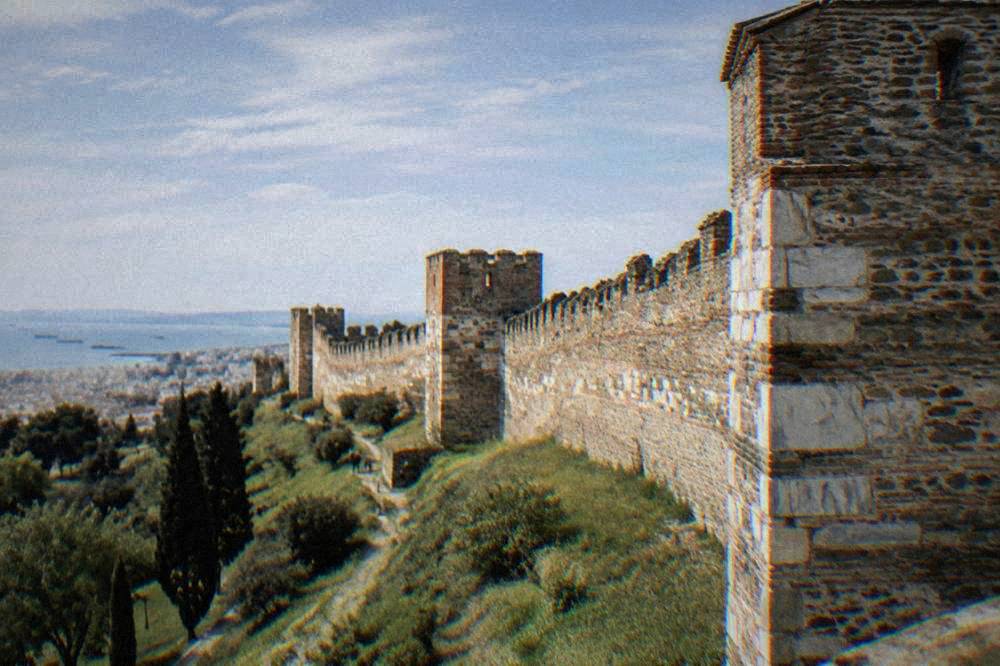
The walls of Thessaloniki are Hellenistic in origin, from the era of the city's founding in 315 BC by Cassander, were expanded in the Byzantine period into a circuit of about 8 km, and were strengthened again under the Ottomans; the fifteen Paleochristian and Byzantine monuments of the city, the walls included, were inscribed on the UNESCO World Heritage List in 1988, and about 4 km of the original line remains visible today. Those figures come from the Ministry of Culture's own monument page and the UNESCO listing, and they are the anchors every traveller should carry: a wall line that has been rebuilt, extended and repaired across more than two millennia, not a single-era construction.
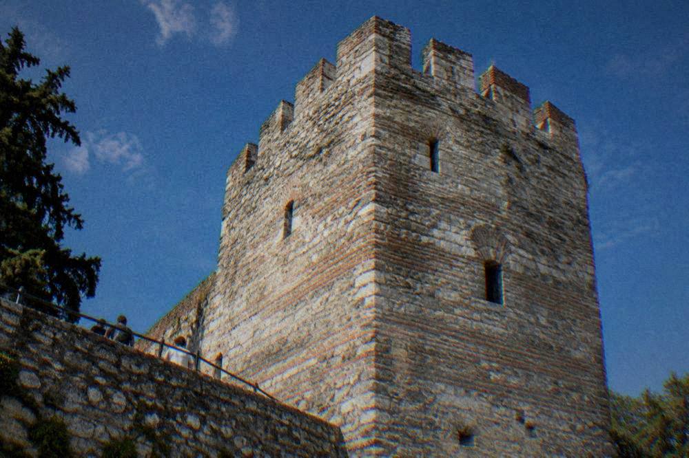
The layering is visible in the masonry itself. Older blocks sit beside later repairs, and the towers along the line vary in shape and technique, which is what a wall looks like when every era from Cassander to the Ottomans has had a hand in it. The Heptapyrgion at the top of the line took its fortress form in the Byzantine and Ottoman periods, and its career as a civilian prison from the late 19th century until 1989 is the most recent chapter: the cells were only emptied in 1989, and the fortress has since passed to heritage use.
The UNESCO inscription matters for how you read the tower. The walls are not listed alone; they are one component of a fifteen-monument property that also includes the Rotunda, the Arch of Galerius complex, Hagia Sophia, the Church of Saint Demetrius, Panagia Acheiropoietos, Hosios David, the Vlatadon Monastery and others. A visitor who walks the walls in the morning and the lower-town churches in the afternoon is, without any extra effort, covering a meaningful share of a World Heritage property on foot.
| Era | What happened to the walls | Source basis |
|---|---|---|
| 315 BC | City founded by Cassander; Hellenistic wall origins | thessaloniki.gr |
| Byzantine period | Expansion to a circuit of about 8 km | Ministry of Culture |
| 1430 | Ottoman conquest; walls strengthened | thessaloniki.gr |
| Late 19th century | Heptapyrgion converted to prison use | Ministry of Culture |
| 1988 | UNESCO inscription, fifteen monuments including the walls | whc.unesco.org |
| 1989 | Heptapyrgion prison closes | Ministry of Culture |
How Do You Get To The Trigoniou Tower In Thessaloniki?
The Trigoniou Tower is reached on foot from the upper town of Ano Poli: the standard approach climbs from the city centre through the lanes of the old upper town to the Heptapyrgion fortress and then follows the wall path a few minutes east to the tower, with the whole climb lying inside a compact area that the metro's Line 1 serves at its lower end; there is no station in Ano Poli itself, so the last stretch is always a walk uphill. The Thessaloniki Metro, open since November 2024 with the Kalamaria extension added on 27 August 2026, runs 05:15 to 00:30 Sunday to Thursday and 05:15 to 02:00 Friday and Saturday, with a basic ticket at 0.60 euro and a daily ticket at 2.50 euro per the metro's own ticket page. The metro gets you to the edge of the centre; the upper town is pedestrian in character, and the lanes are part of the experience.
Three practical approaches describe the walk. The first and commonest starts at Aristotelous Square and climbs north through the old town streets, past the Church of Saint Nicholas Orfanos, toward the Heptapyrgion. The second comes up from the eastern side, through the lanes below the Vlatadon Monastery, which shortens the climb to the wall path itself. The third, and the one walkers with a map enjoy, follows the wall line downhill from the tower along the visible stretches toward the eastern walls, ending the circuit in the city centre.
The hill is real. Ano Poli sits well above the lower city, the lanes are cobbled and stepped in places, and shoes that grip matter more than shoes that look good. Water and sun cover matter in summer: the July mean daily high at the HNMS Thessaloniki Mikra station, 1959 to 2010, is 31.7 C, and the wall path has little shade. In winter the same exposure cuts the other way, with a January mean low of 1.5 C on the same station record, so the viewpoint is brisk at dusk in the cold months.
| Approach | Route in brief | Character |
|---|---|---|
| From Aristotelous Square | North through Ano Poli lanes, past Saint Nicholas Orfanos, to the Heptapyrgion and the tower | Classic full climb, about the whole upper town |
| From the east | Up via the lanes below the Vlatadon Monastery to the wall path | Shorter, arrives at the wall line directly |
| Along the walls | Follow the visible wall stretches east from the tower, then descend to the centre | Best for the surviving masonry |
Neighbouring pages on this site cover the pieces around the tower: the fortress history is set out in Heptapyrgion, the neighbourhood walk in Ano Poli, and the monastery inside the walls in Vlatadon Monastery.
What Can You See From The Trigoniou Tower In Thessaloniki?
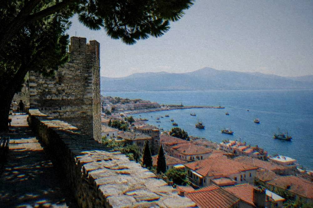
From the ground at the Trigoniou Tower the view spans the entire Thermaic Gulf side of Thessaloniki: the tiled roofs of Ano Poli falling away to the south, the seafront line of the Nea Paralia promenade and the White Tower, the port, and across the water the coast toward Perea and, on clear days, the mass of Mount Olympus, which sits about 86 minutes by road from the city at the Prionia trailhead. The tower's position at the wall's high point is exactly why it exists: the same line of sight that served defenders now serves photographers, and the sunset hour over the gulf is the one photographers time their visit around.
The view rewards reading as much as looking. Directly below lies Ano Poli, the old upper town that survived the Great Fire of 1917, which devastated the lower centre and left 73,000 people homeless, the figure the municipality's own history pages record. That is why the upper town's fabric feels different from the grid of the rebuilt centre: the fire stopped at the hill. To the south the modern city runs to the water, and the seafront promenade, the Nea Paralia, is a walking line rather than a swimming beach; swimming is done further out at Perea, about 28 minutes by road.
To the west the port and the flat of the lower city complete the frame, and beyond the rooftops the dome of the Rotunda and the line of Egnatia street can be picked out by eye. The view is also a planning tool: a visitor who studies the panorama from the tower can read the whole walking geography of Thessaloniki, from the Byzantine monuments of the centre to the sea, before descending into it.
When Is The Best Time To Visit The Trigoniou Tower In Thessaloniki?
The Trigoniou Tower and the open-air wall path have no timed closure, so timing is about weather and light: on the HNMS Thessaloniki Mikra record, July averages a 31.7 C high and December the heaviest rainfall at 55.1 mm. Walk late afternoon in the warm months, midday in winter, and the sunset hour is the popular choice year-round. The climate figures are station means, not a forecast, but they frame the decision honestly: hot exposed stone at midday in summer, damp cobbles possible from November onward, and long golden light from spring to autumn.
The wall path has almost no shade, so in July and August the hours either side of midday are the sensible ones. Autumn brings the Dimitria festival period to the city, reported at 1 to 26 October in 2026, and the Film Festival follows in November; an upper-town walk slots easily alongside either. Spring is mild on the same station record, with a May mean high of 24.6 C, and the wildflowers on the slopes below the walls are at their best then. The rest of the planning pages sit on Thessaloniki Travel Guide.
There is no bad light at the tower, only different light. Morning sun falls on the city side and lights the gulf; evening sun comes off the water and silhouettes the towers. What there is not is any timed closure of the open-air wall path itself, and any interior arrangement at the Heptapyrgion should be confirmed on the official page before a visit depends on it.
| Month | Mean high C | Mean low C | Rain mm | Notes for the walls walk |
|---|---|---|---|---|
| January | 9.3 | 1.5 | 37.7 | Brisk, occasional frost at dawn |
| April | 19.1 | 7.9 | 36.1 | Mild, spring growth on the slopes |
| July | 31.7 | 19.3 | 23.8 | Hot and exposed; walk early or late |
| August | 31.4 | 19.1 | 19.3 | Lowest monthly rainfall on the record |
| October | 21.2 | 11.3 | 43.0 | Festival season, warm afternoons |
| December | 10.9 | 3.2 | 55.1 | Highest monthly rainfall; check the sky |
Figures: HNMS Thessaloniki Mikra station, 1959 to 2010.
How Does The Trigoniou Tower Fit Into A Day In Thessaloniki?
A practical upper-town circuit runs two to three hours: start at Aristotelous Square, climb through Ano Poli past the Church of Saint Nicholas Orfanos, visit the Heptapyrgion fortress, walk the wall path to the Trigoniou Tower for the panorama, then descend via the Vlatadon Monastery into the centre, where the White Tower, the Rotunda and the Museum of Byzantine Culture complete a day that touches a large share of the city's UNESCO-listed fifteen monuments. The tower is the hinge of that day: it sits at the top of the walk and hands you back to the city with the whole geography already understood.
For a first visit, the one day in Thessaloniki plan treats the upper town as the morning and the seafront as the afternoon, which is the shape the geography suggests. With more time, three days in Thessaloniki leaves room for a day trip, and the drive times put Pella at about 43 minutes, Vergina at about 62, and Meteora at about 154, the last of which is a full day rather than a half. The upper town itself repays a second pass: the lanes carry detail, from painted facades to small churches, that a single climb only samples.
Two museum anchors sit at the foot of the descent. The Archaeological Museum of Thessaloniki lists 09:00 to 17:00 daily from 1 April to 31 October, and 09:00 to 17:00 closed Tuesday from 1 November to 31 March, at 10 euro full and 5 euro reduced. The Museum of Byzantine Culture lists summer hours of 08:00 to 20:00 daily and winter hours of 08:30 to 15:30 Monday and Wednesday to Sunday, at the same prices, and its visiting page is where the White Tower's own 8 euro full and 4 euro reduced ticket, in force from 1 April 2026, is also documented. State museums are free on 6 March, 18 April, 18 May, the last weekend of September and 28 October.
| Stop on the circuit | What it adds | Verified anchor |
|---|---|---|
| Aristotelous Square | Starting point, the Hebrard-era centre | Square laid out after the 1917 fire |
| Church of Saint Nicholas Orfanos | Byzantine frescoes in Ano Poli | Working church, free, open outside services |
| Heptapyrgion | Fortress at the top of the walls | Prison until 1989, per the Ministry of Culture |
| Trigoniou Tower | The panorama over the gulf and the city | Open-air wall-path landmark |
| Vlatadon Monastery | Monastery inside the walls | UNESCO ensemble component |
| Museum of Byzantine Culture | Context for everything above | 08:00 to 20:00 summer, 10 euro full |
For a different angle on the city from above, the OTE Tower on the seafront offers a rotating experience with a light meal; the pairing of an upper-town wall walk and a seaside tower rotation covers Thessaloniki's vertical dimension in one day. Food tours also pair naturally with an Ano Poli morning, since the upper town walk ends within reach of the central markets.
What Should You Know Before Walking The Walls Of Thessaloniki?
Three practical points carry the walk: the lanes of Ano Poli are stepped, cobbled and steep, so footing and water decide comfort; the open-air wall path has no documented ticket or timetable, while the Heptapyrgion's interior arrangement should be confirmed on the official page before a visit depends on it; and the upper town is a lived-in residential neighbourhood, so the etiquette of any old quarter applies, with the churches along the route working houses of worship that are free to enter and open outside services. None of this is complicated, and all of it rewards five minutes of preparation.
The surface underfoot changes repeatedly: worn cobbles, stone steps, patched paving and, after rain, slick patches that dry slowly in shade. The HNMS Thessaloniki Mikra station record, 1959 to 2010, counts 11.0 rain days in November and 12.7 in December, the highest on the monthly table, so a winter walk should carry a view to the sky. In summer the same exposure asks for a hat and water, since the wall path is open ground above a stone city that holds its heat.
The emergency number in Greece is 112, the country is in the Schengen area, and the currency is the euro. The climate resilience fee exists at accommodations, is collected by the accommodation, is charged per room per night and is higher from April to October. For orientation help on the ground, a reported tourist information centre sits at Aristotelous Square, with a phone line, +30 2310 229070, listed by the city's tourism site; confirm details locally before relying on it.
Is The Trigoniou Tower Area Worth The Climb In Thessaloniki?
The Trigoniou Tower stretch is the single most concentrated piece of Byzantine Thessaloniki open to a casual walk: a fortress that held a prison until 1989, roughly 4 km of visible wall from an original circuit of about 8 km, UNESCO-listed monuments inside the lines, and a panorama that takes in the gulf, the seafront and the rooftops of the old upper town, all reached on foot from the city centre without a ticket for the open-air parts. That combination is what the lower city cannot offer: the centre has the museums and the churches, but the walls give the city its physical shape, and the tower is the point where that shape is easiest to see.
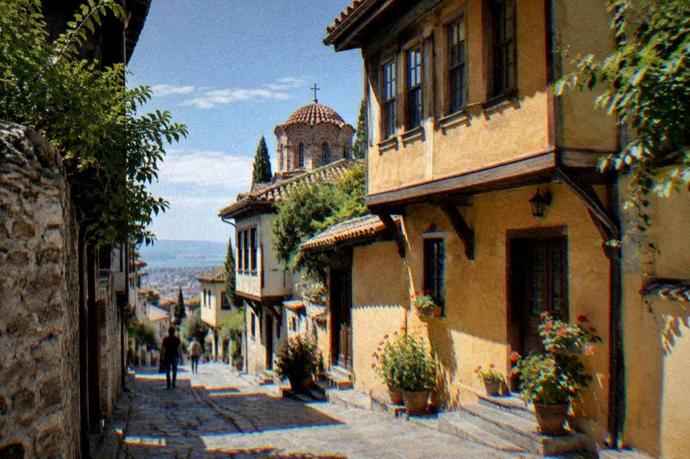
The neighbourhood context matters to the answer. Ano Poli is not a museum district; it is the part of Thessaloniki that the Great Fire of 1917 did not reach, and its lanes carry the older domestic fabric of the city alongside the monuments. A slow walk that stops for the small things, a painted wall, a courtyard, a church door, repays the climb as much as the headline view does. The site's free things to do in Thessaloniki guide treats the walls and the churches together for exactly this reason: the open-air fortifications and the working churches cost nothing.
For depth, the pairing is deliberate: the walls explain why the Byzantine churches of the centre survived in the density that earned the UNESCO inscription in 1988, and the museums below explain what was found when the city dug. A traveller who does the tower first, with the whole city spread out below, reads everything that follows with a map already in their head.
Common Questions About The Trigoniou Tower In Thessaloniki
Is the Trigoniou Tower in Thessaloniki free to visit?
The tower itself is an open-air structure on the public wall path and has no documented ticket. The Heptapyrgion fortress beside it has its own arrangement; confirm the current price and hours on the official page before a visit depends on entering it.
How do I get to the Trigoniou Tower from central Thessaloniki?
On foot: climb through Ano Poli from Aristotelous Square, past the Church of Saint Nicholas Orfanos, to the Heptapyrgion, then follow the wall path to the tower. The metro serves the centre at its lower end, with a basic ticket of 0.60 euro per the metro's ticket page, but the last stretch is always uphill on foot.
Are the Byzantine walls of Thessaloniki UNESCO listed?
Yes. The walls are part of the Paleochristian and Byzantine Monuments of Thessaloniki, a property of fifteen monuments inscribed on the UNESCO World Heritage List in 1988.
How long is the wall walk to the Trigoniou Tower?
The upper-town circuit from Aristotelous Square, through Ano Poli to the Heptapyrgion, the tower and back down, fits comfortably in two to three hours at a walking pace with stops.
Can you see Mount Olympus from the Trigoniou Tower?
On clear days the mountains across the Thermaic Gulf are visible from the wall's high point, and the Olympus massif sits across the water from the city; the Prionia trailhead on the mountain is about 86 minutes by road from Thessaloniki.
Is the climb to the Trigoniou Tower difficult?
The climb is steep in stretches, with cobbled and stepped lanes, but it is short and untimed. Shoes with grip and water in summer are the main preparation; the wall path is exposed, and the July mean daily high on the HNMS Thessaloniki Mikra station record, 1959 to 2010, is 31.7 C.
The Trigoniou Tower is the point where Thessaloniki shows its own outline: the walls, the upper town beneath them, and the gulf that made the city. Walk up once, and every monument below reads differently afterwards.